Why Asanteman
Source: Compiled from public sources: Wikipedia (Ashanti Region, Kumasi), Lonely Planet. Not yet reviewed by the regional tourism office; Ghana Tourism Authority (visitghana.com/ashanti-region) (link).
Asanteman, known on maps as the Ashanti Region, lies in the middle belt of southern Ghana. Its capital is Kumasi, about 200 km from Accra. It covers 24,389 km², and at the 2021 census it was Ghana's most populous region, with 5,440,463 people. It is organised into 43 metropolitan, municipal and district assemblies.
The heart of the Asante kingdom
Asanteman is the homeland of the Asante, the dominant group among the Akan people. The Asantehene, currently Otumfuo Osei Tutu II, is the head of the Asante kingdom and lives in Kumasi. The kingdom's history, regalia and ceremonies are still a living part of life here, not only a museum subject.
What you can do
- Visit Manhyia Palace Museum in Kumasi, the former royal residence built in 1925, now a museum. The Asantehene lives in a newer palace beside it.
- Walk through Kejetia Market, often described as the largest open-air market in West Africa, with more than 10,000 stalls and shops.
- See the Asante crafts, including kente weaving at Bonwire, Adinkra cloth printing at Ntonso and wood carving at Ahwiaa.
- Time your visit with an Adae ceremony, held on a repeating 40 to 42 day cycle (see the Cultural calendar).
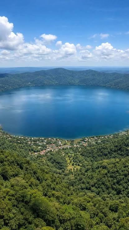
- Get into nature at Lake Bosumtwi, Bobiri Forest Butterfly Sanctuary, Owabi Forest Reserve and Bird Sanctuary, Bomfobiri Wildlife Sanctuary and Kogyae Strict Nature Reserve.
Plan well
Use the Travel Planner to build an itinerary, read Getting Around for how to reach and move around the region, and check Visa and Entry before you book.
From the Ghana Tourism Authority
- Kumasi is described as the ancient capital of the region and was founded in 1695 by the Asantehene Osei Tutu.
- At Manhyia Palace the Asante king sits in session every sixth Sunday, with processions, drumming and music.
- Other sites named include Kumasi Fort and the Military Museum, and the Besease Shrine, described as over 300 years old.
- The region is nicknamed the "Kingdom of Gold". Obuasi, about 50 km south-west of Kumasi, has a gold-mining heritage, and tours can be arranged.
- Akan and Twi are the main languages.
Facts and figures
- Area: 24,389 km², about 10.2% of Ghana, the third largest of Ghana's 16 regions.
- People: 5,440,463 at the 2021 Census, the most populous region and roughly one-sixth of Ghana. About 223 people per km². Akan people make up 94.2% of citizens by birth.
- Neighbours: Bono, Bono East and Ahafo to the north, Eastern to the east, Central to the south and Western to the south-west.
- Districts: 43 assemblies today (1 metropolitan, 18 municipal and 24 district). The region had 10 districts before 1988, then 18 (1988), 21 (2004), 27 (2008), 30 (2012) and 43 (2018) as assemblies were divided.
- Economy: services, agriculture and natural resources. Cocoa, yam, manganese, bauxite and gold are among the region's products.
- Learning and health: three public universities, including KNUST in Kumasi, and about 1,650 health facilities, mostly community health posts and health centres.
- Roads: the N6 links Kumasi with Accra, and the N8 and N10 link the region with the Central Region.
Figures are from the 2021 Population and Housing Census as reported on Wikipedia (Ashanti Region).